|
D&D Travel's Pacific Northwest, continued... [back to page 1] |
|
|
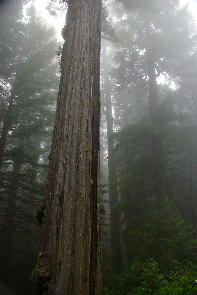
An early morning mist blankets the giant trees of Redwood National Park, south of Crescent City, California... |
|
|
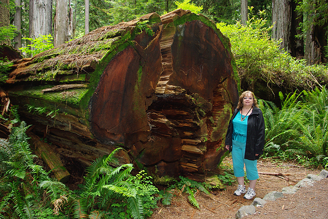
A fallen trunk allows all manner of plant life to flourish in the coastal forests of northern California...As you can see, these are large trees...this one still quite small however, compared to many others in the forests! |
|
|
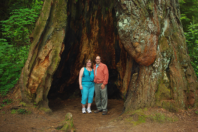
Another tourist offered to take a shot of us in the hollowed-out trunk of a giant Redwood. Here, you can see how massive these behemoths really are! |
|
|
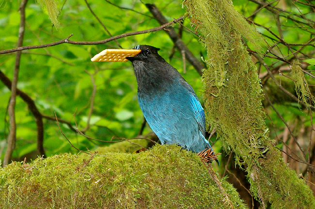
With a stolen cracker he was unwilling to drop, muffled "tweets" emanated from this brilliantly-colored Corvid (part of the Crow family) - encountered along a Redwood forest trail... |
|
|
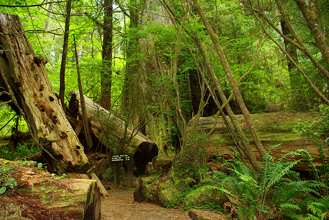
Several state parks make up Redwood National Park...Above is one of many trails leading through old-growth forests, with trees and fallen trunks covered in moss, ferns and wildflowers... |
|
|
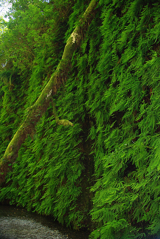
A fallen tree trunk offers some scale to 100-foot vertical walls, covered with many species of fern in Fern Canyon - one of the main attractions in Prairie Creek Redwoods State Park in Humboldt County, California. Portions of the canyon were used as locations in the film The Lost World - Jurassic Park and the BBC's Walking with Dinosaurs! The canyon is reached by a hiking trail at the end of a long dirt road - Home Creek flowing gently through it. It is well worth the hike!! |
|
|
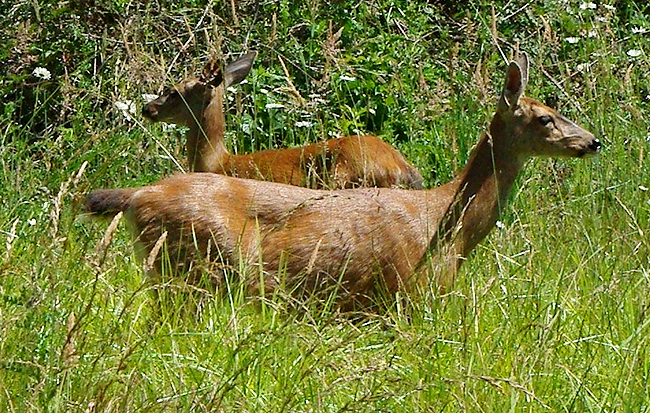
A pair of deer give us the eyeball from a meadow in Redwood National Park... |
|
|
A back-country road on the way to King Estate Winery outside of Eugene, Oregon... |
|
|
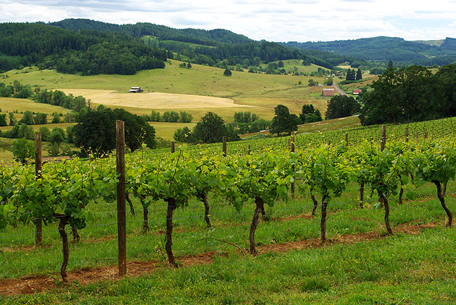
The vineyards at King Estate Winery. We experienced an excellent lunch on the restaurant patio, overlooking the vineyards this day...Oregon produces some fine wine, with its many micro-climates that suit a number of grape varieties...In fact, there are over a dozen wineries in just this area alone - Lane County. |
|
|
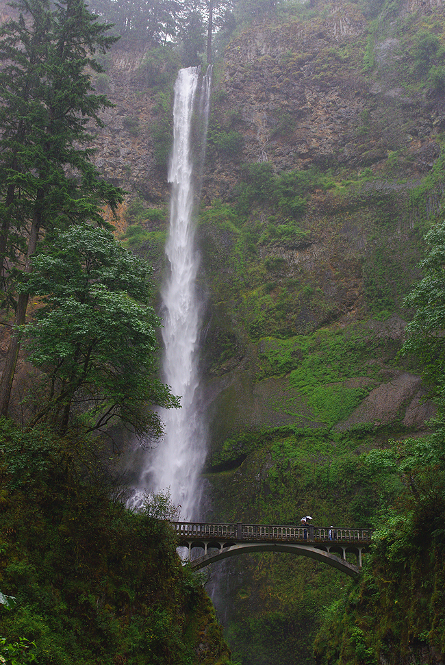
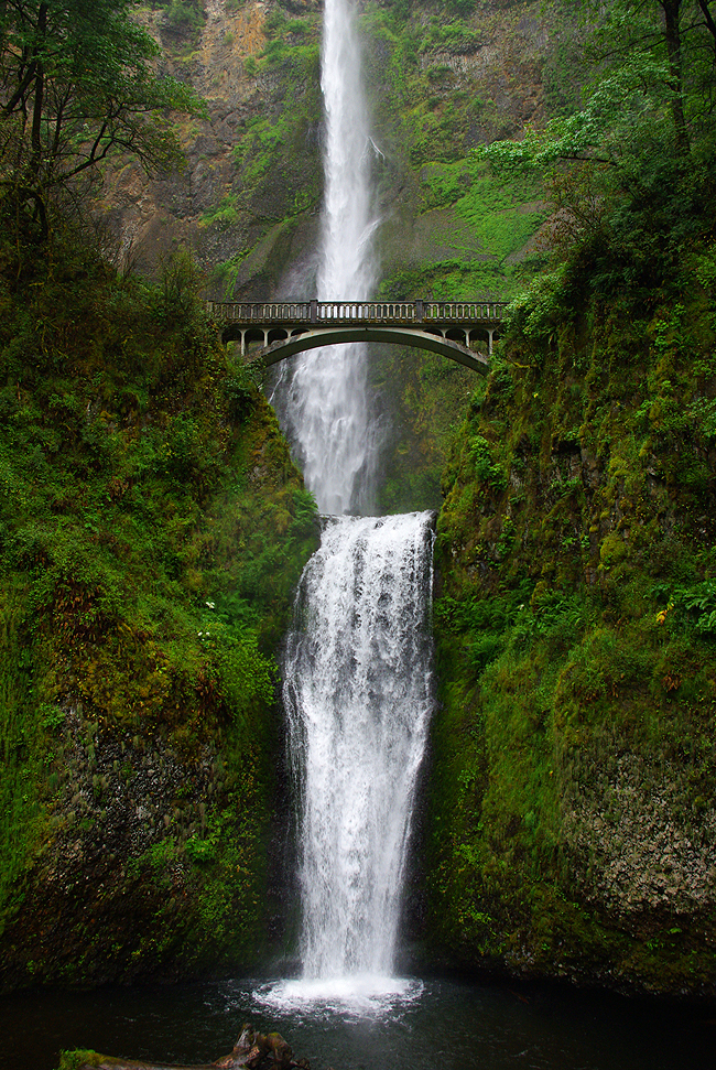
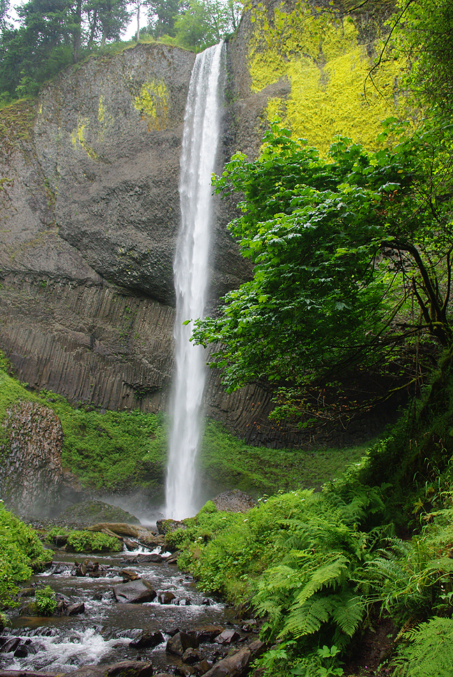
620-foot Multnomah Falls, along The Columbia River Scenic Highway - Oregon Historic Route 30. The old road traverses a portion of the Columbia River Gorge National Scenic Area. Multnomah Falls is the second highest in the United States...as you can see, we needed two shots to get it all in! The highway was built between 1913 and 1922 and the somewhat narrow road (yes, it passes over the bridge in this shot!) showcases some of the most awe-inspiring scenery (not to mention waterfalls!) you'll ever behold..."Simply amazing" is the best we can do! |
|
|
The lower portion of Multnomah Falls...The Columbia River, into which it eventually flows, is the longest river in the Pacific Northwest, at 1243 miles. It rises from the Rocky Mountains in British Columbia and flows along the Oregon-Washington border, emptying into the Pacific Ocean northwest of Portland... |
|
|
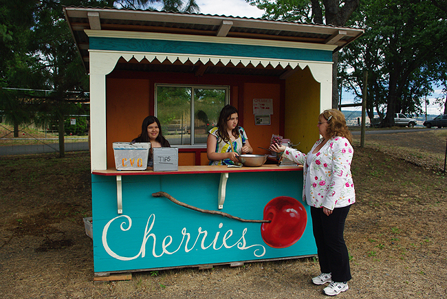
Central Oregon produces some great fruit! We stopped for a pound of freshly-picked cherries, sold by two sisters at this cherry stand along Route 30 near Cascade Locks...Needless to say, the cherries were delicious! |
|
|
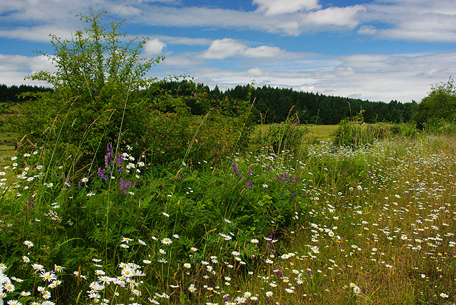
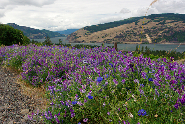
A view of the Columbia River looking northwest toward Washington State. Amazing displays of wildflowers greet travelers along Route 30 in this area of Multnomah County, Oregon |
|
|
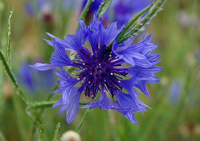
Bachelor's Button (Cornflower) in gorgeous bloom... |
|
|
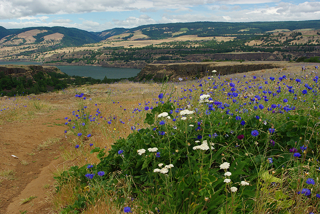
A ridge trail in the Tom McCall Preserve in Rowena, Oregon - spring flowers ablaze with color. The preserve is so diverse partly because it lies in the transition zone between the moist, heavily-forested west side of the Cascades and the drier bunch grass prairies of the east. It is located about 11 miles east of Hood River and encompases 271 acres. Wildflowers bloom along the cliffs and all the way down into the valley below. The area is partly managed by the Nature Conservancy...This was incredibly impressive! |
|
|
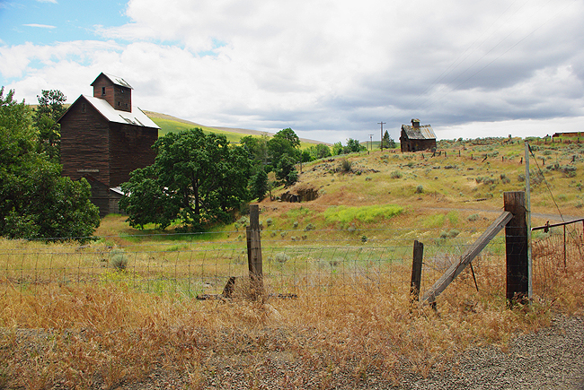
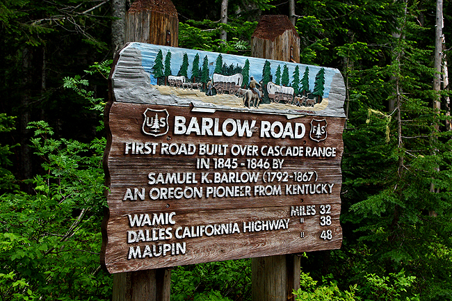
The ghost town of Boyd, just off Oregon Route 197 south of The Dalles and just north of the town of Dufur. To the west lies the Mount Hood National Forest and Mount Hood - at just over 11,000 feet in elevation. Near here passed the Barlow Road - the last portion of the famous Oregon Trail that carried many pioneers by wagon from Missouri to its end at Oregon City... |
|
|
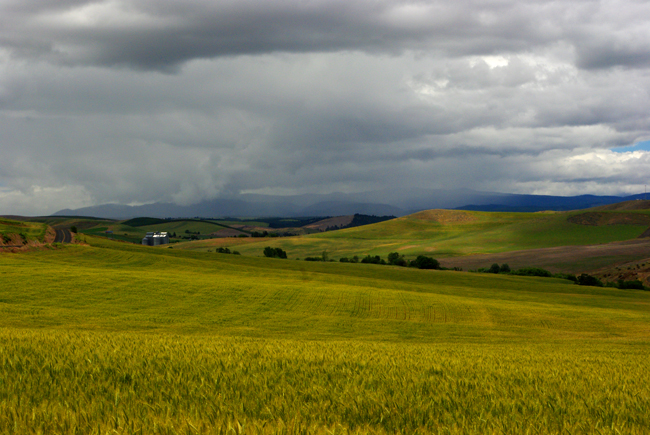
Just outside of Boyd, a golden field awaits the arrival of an ominous-looking local rainstorm off to the west... |
|
|
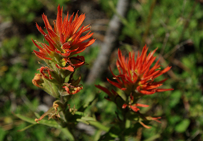
Flowers along the Barlow Road...A scene no doubt witnessed by many a pioneer traveler. |
|
|
|
|
|
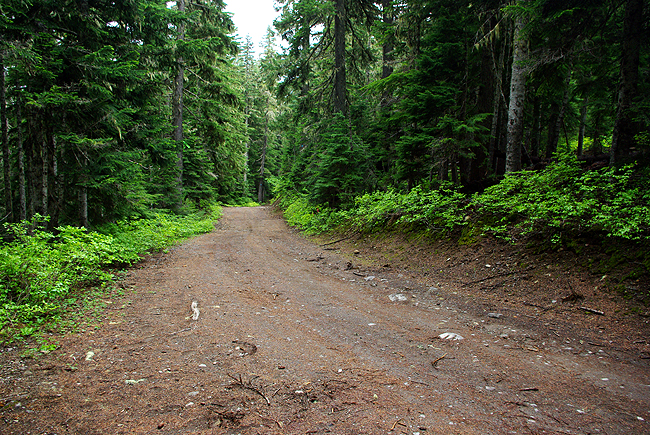
The Barlow Road, National Forest Road 3530 - looking west, near Highways 35 and 26. The portions of the road that traverse National Forest land are, fortunately, preserved and maintained pretty much as they were in the mid 1800s when pioneers labored to travel its length, bound for Oregon City. In several areas, original wagon ruts are still plainly visible, in honor of the folks who passed by - and died - along the route. |
|
|
A final image - Latourell Falls - along the Columbia River Highway Route 30 in Guy W. Talbot State Park. It is a "plunge" falls, at 249 feet in height...Just another of the many fabulous sights along the historic portion of Route 30... We hope you have enjoyed this brief tour of the Pacific Northwest! It was tough to choose 42 images from over 500 initially taken! These can only begin to illustrate the wondrous scenery that awaits you in this part of the country... You'll find a trip here to be one of the most satisfying you'll likely ever take... - Donna and Dennis, D&D Travel
Land Tours - Cruising - Travel Glossary - Gallery - Email Us |