|
|
D&D Travel presents - a look at Northern Arizona - Sedona, Jerome and a portion of Historic Arizona US Route 66... |
| Northern Arizona presents some lovely scenery...from the Red
Rocks of Sedona to the longest section of preserved historic Route
66 - the Mother Road - in the country. Route 66 ran from Chicago to
Los Angeles and there are many other portions still remaining in a
number of western states. While many points of interest along the
road are disappearing, much of classic Americana still exists and a
"road trip" along this highway can still be the adventure it once
was! Here are 40 images from the Sedona area of Northern
Arizona including Jerome and of Route 66 between Seligman and
Williams. Hope you can make the trip to at least one section of
historic 66 in your lifetime! Please enjoy... -Donna and Dennis Hubbs, D&D Travel [HOME] All photos c. 2009 D. Hubbs (Note: high-quality images -allow ample time to load) |
||
|
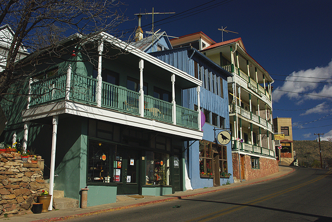
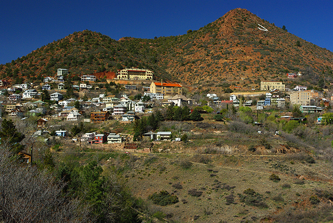
Above and the next 4 images below: Incorporated on the side of Cleopatra Hill in 1899, the town of Jerome sits atop rich ore deposits, about midway between Prescott and Sedona in Northern Arizona. In the mid 1920s, the town population swelled to almost 15,000 before its decline. In the 1950s, that population dwindled to about 100, making it an official "ghost town." Today, it is a thriving tourist destination and a National Historic Landmark... |
||
|
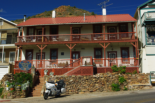
The Ghost City Inn B&B sits at a 90 degree bend in the road - State Route 89A - in Jerome |
||
|
|
||
|
Colorful buildings line Main Street in Jerome |
||
|
Cleopatra Hill... |
||
|
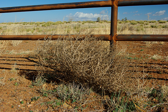
On SR89A between Cottonwood and Sedona, a lone tumbleweed sits against its new home - trapped along a fence. It's a common sight on windy days along Arizona's highways... |
||
|
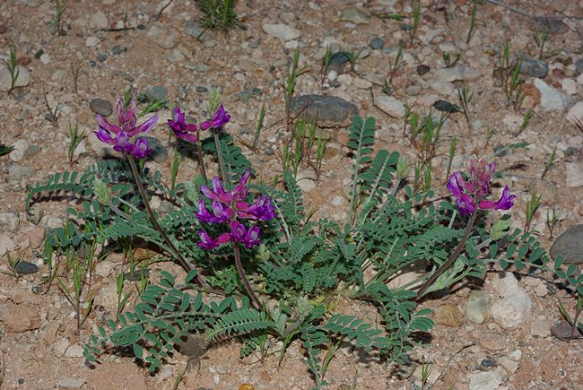
Above and immediately below, wildflowers bloom in the desert sun along a trail leading down to the Verde River in Dead Horse Ranch State Park, Cottonwood, AZ |
||
|
|
||
|
|
||
|
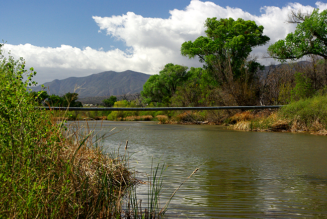
Both images above: The Verde River flows along dry banks in Dead Horse Ranch State Park. If any greenery pops up, you can be sure water is not too far off! |
||
|
Like something from a middle earth fairy tale, a tree stump resembles a mythical animal, complete with snout, along Tavasci Marsh Trail in Deadhorse. A stream passes by to the left, on its way to the Verde River... |
||
|
Above and immediately below: The Lagoon, fed by the Verde River at Deadhorse Ranch State Park. A lovely sight in such a dry environment! |
||
|
Fishermen enjoy the Lagoon...and its aquatic population! |
||
|
Soapberries display their golden color along Bunkhouse Trail in Red Rock State Park, Sedona |
||
|
Climbing along the trail toward the "House of Apache Fire" at Red Rock SP... |
||
|
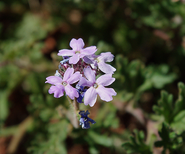
Look carefully and you'll find a number of wildflowers blooming trailside in the Arizona sun |
||
|
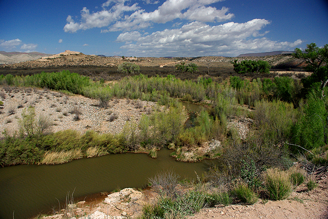
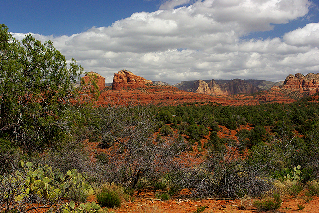
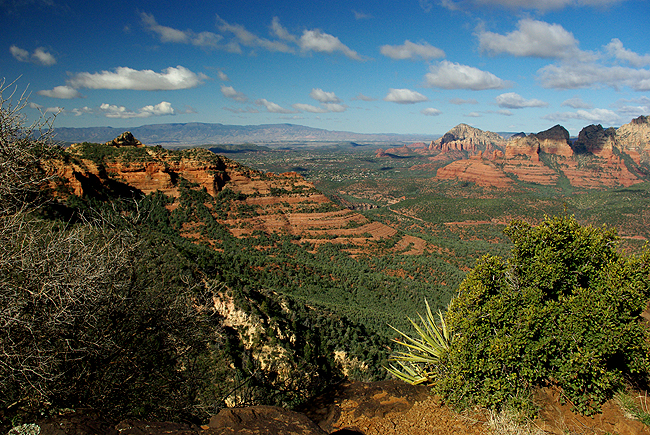
Above and immediately below: Two spectacular views of Sedona's red rocks... |
||
|
|
||
|
|
||
|
|
||
|
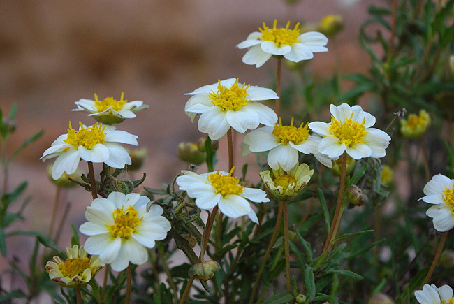
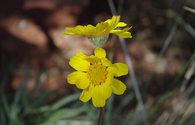
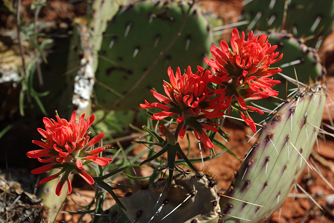
Above 3 images: More wildflowers basking in the desert sun at Red Rock State Park, Sedona... |
||
|
The "House of Apache Fire" atop the Apache Fire Trail at Red Rock, built by Jack and Helen Frye in 1946. Frye was the president of TWA back then and used the area as a retreat. The land, ranch and the house shown above were eventually owned by a mining company and subsequently traded to the State of Arizona in 1986; Red Rock State Park opened to the public in 1991. The home is currently vacant and fenced off from the public, but the views from all around are stunning |
||
|
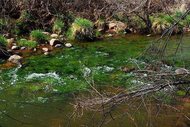
Oak Creek, with bright green algae (actually un-enhanced!) just below the water's surface, flows lazily through through Red Rock State Park... |
||
|
Another view of Oak Creek as it flows toward Oak Creek Canyon... |
||
|
Yes, there are waterfalls in Arizona...at least small ones! This lovely little cascade is just off SR89A in Jerome. We discovered it quite by accident on a side road just below the town center... |
||
|
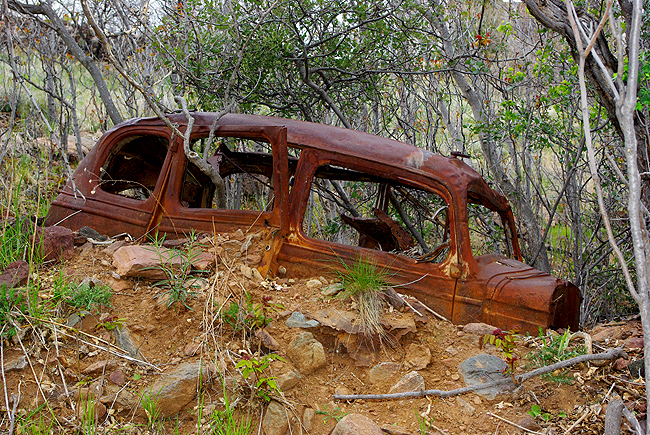
A relic of the past...A rusted frame of an old car, probably from the 1930s - sits half-buried just above the waterfall in the image above |
||
|
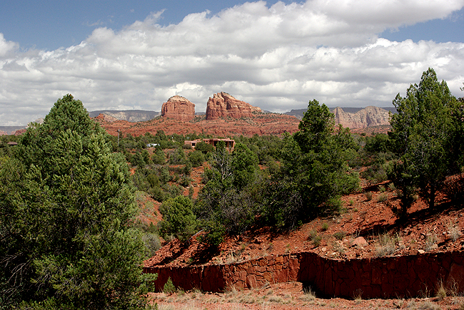
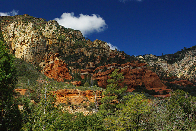
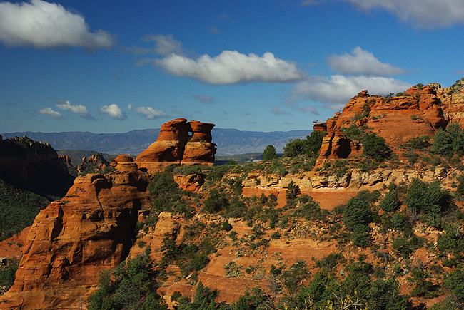
The Red Rocks of Sedona, whose colors change as the sun moves across the sky. This scene is in Oak Creek Canyon, midway between Sedona and Flagstaff on SR89A
|
||
|
Above and immediately below: Historic Arizona US Route 66, home of Cruiser's Cafe 66 in Williams. Williams is also the base for the Grand Canyon Railway, which makes daily runs north, directly to the South Rim of the Grand Canyon. The train is a great way to visit the canyon, leaving your car (and the traffic) behind! Overnight stays in both Williams and the park can be arranged as a package with the railway...Just ask us for details! |
||
|
|
||
|
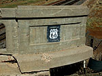
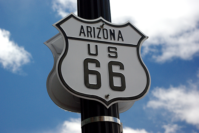
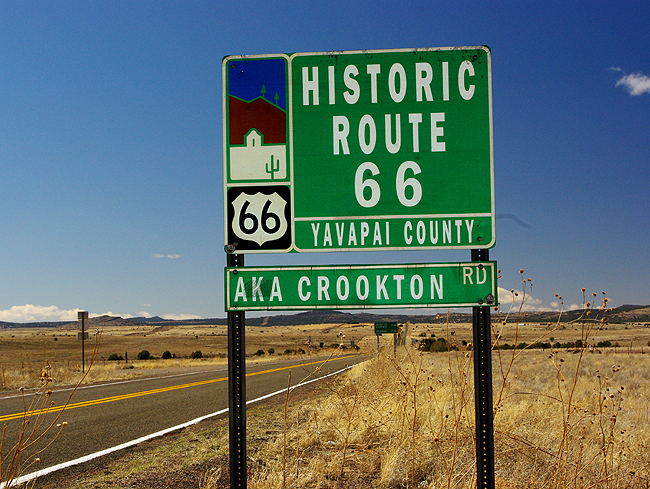
Part of the original 66 alignment (paved over the original road surface) looking west between Ash Fork and Seligman...This stretch is also known as Crookton Road. 66 originally ran for some 2400 miles, across eight states, deadending on Santa Monica and Ocean Avenues in Santa Monica, CA. The famous road became a reality on November 11, 1926, at least on paper...Officially in 1926, about 800 miles were already paved; the remaining 1600 plus miles were either gravel or graded dirt, asphalt covered bricks or just wood planks! In 1937, the highway was finally paved completely. The last stretch of Old Route 66 was bypassed in Williams, AZ by Interstate 40, in 1984....but the Mother Road - the Main Street of America - lives on, with some pretty decent portions kept alive and maintained in the various states it passes through! In fact, many road maps are re-adding the "66" designation in their new versions. For a fabulous book on the subject, click here! |
||
|
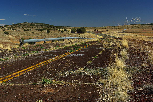
Looking east from the Crookton (railway) Overpass, the original 66 pavement, yellow lines still visible. You can see where it veers off from the the "new" pavement toward the top of the image... |
||
|
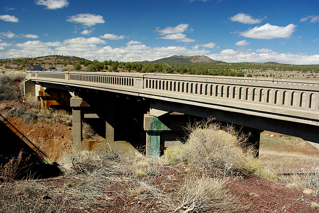
The old Crookton Overpass bridge (circa 1930s) in Ash Fork (looking west), now closed off at each end. The Santa Fe Railroad is still quite active however, passing underneath...The current highway bridge is just to the left (out of frame). The pavement shown in the previous image connects to this now defunct crossing. Here is a link to the area with turn-by-turn directions to parts of Arizona Route 66 that are still visible and/or driveable: http://www.historic66.com/arizona/det-az3.html. You may also click here for further details on Ash Fork and the bridge... |
||
|
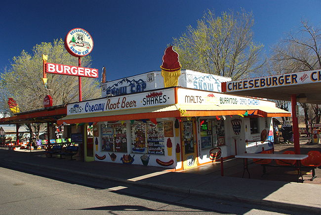
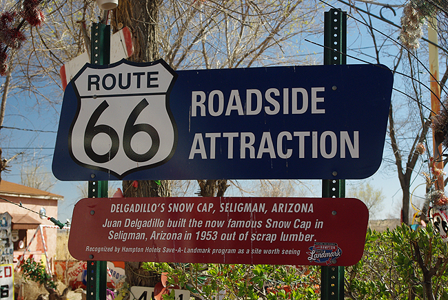
The famous Snow Cap Drive-in in Seligman, directly on Historic 66...Co-owner Juan Delgadillo passed away several years ago, but his legend continues on...his brother Angel is still with us - and the burgers are still great! This is a must-stop for any 66 traveler! |
||
 |
||
|
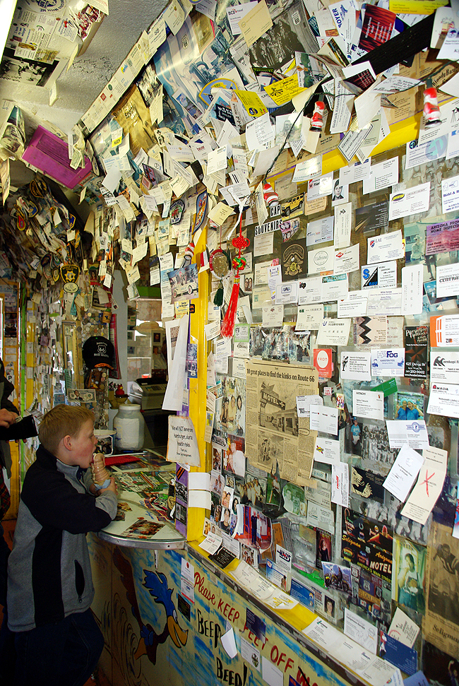
Inside the Snow Cap - our business card is actually buried in here somewhere, from a visit several years earlier! Folks from all over the world, literally, stop in to sample a bit of classic Americana, rapidly vanishing in many places but lovingly preserved here in Seligman! |
||
|
Inside the Route 66 Gift Shop in Seligman, adjacent to the Snow Cap |
||
|
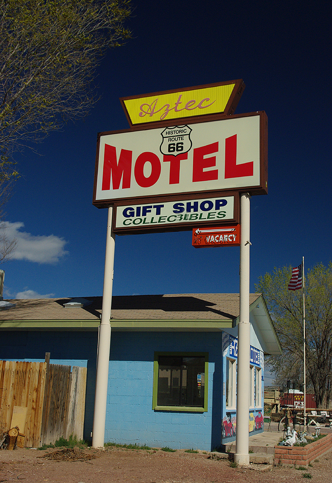
Another Seligman icon - the Aztec Motel, opposite the Snow Cap |
||
|
Finally, one of the most famous signs along the entire Mother Road - Phillips 66! Click here for more of Arizona - The Desert Botanical Garden! |


|

Land Tours - Cruising - Travel Glossary - Gallery - Email Us